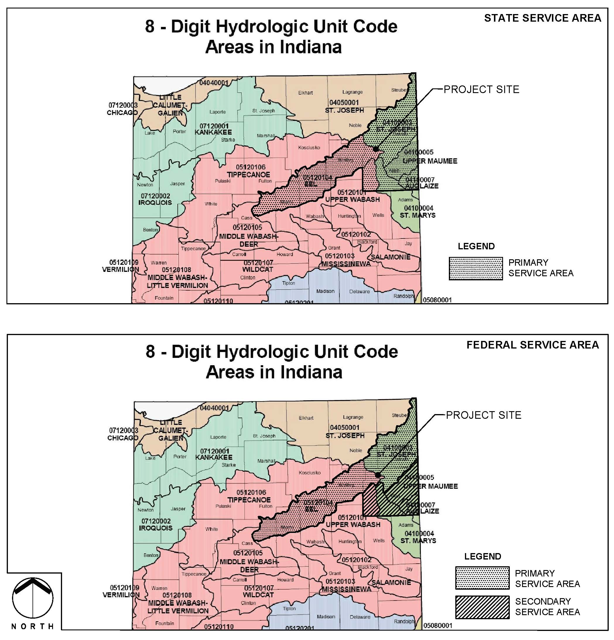
The Openings Mitigation Bank straddles a continental divide between two major watersheds. The Bank falls within watershed units of the Eel and St. Joseph River watersheds [USGS Hydrologic Unit Code (HUC) 05120104 and 04100003, respectively]. Specifically, the Bank falls on the border of the Eel River-Berward Ditch/Shoaf-Dawson Ditch and Willow Creek-Willow Creek Ditch subwatersheds (USGS HUC 05120104010010 and 04100003090080, respectively).
For federally permitted projects, the Primary Service Area of the Bank will include all of the Eel (05120104) and St. Joseph River (04100003) watersheds. In addition, for impacts to isolated wetlands under Indiana’s Isolated Wetland Law (IC 13-18-22) the Primary Service Area of the Bank shall include the Eel and St. Joseph River watersheds as well as those portions of the Upper Maumee, Auglaize, St. Marys, and Upper Wabash River watersheds (USGS HUCs 04100005, 04100007, 04100004, and 05120101, respectively) within Allen County.
A Secondary Service Area shall be available for other federally permitted projects within Allen County. Applicants may use the Bank at the discretion of the federal permitting agency/authority having jurisdiction. Federally permitted projects within the Secondary Service Area may require higher credit to impact ratios.
Find your Watershed by using the IDEM HUC Finder.
Enter Longitude; Latitude (ex. -86.00000; 41.00000) or enter address for best results.